Seventeen test pits were excavated in Myslinka by c. 20 local people in autumn 2019 – early 2020 to an average depth of 1m, three within house plots and 14 on the village green. A total of 1,071 finds were recovered, with all dateable artefacts derived from the late seventeenth – twentieth century.
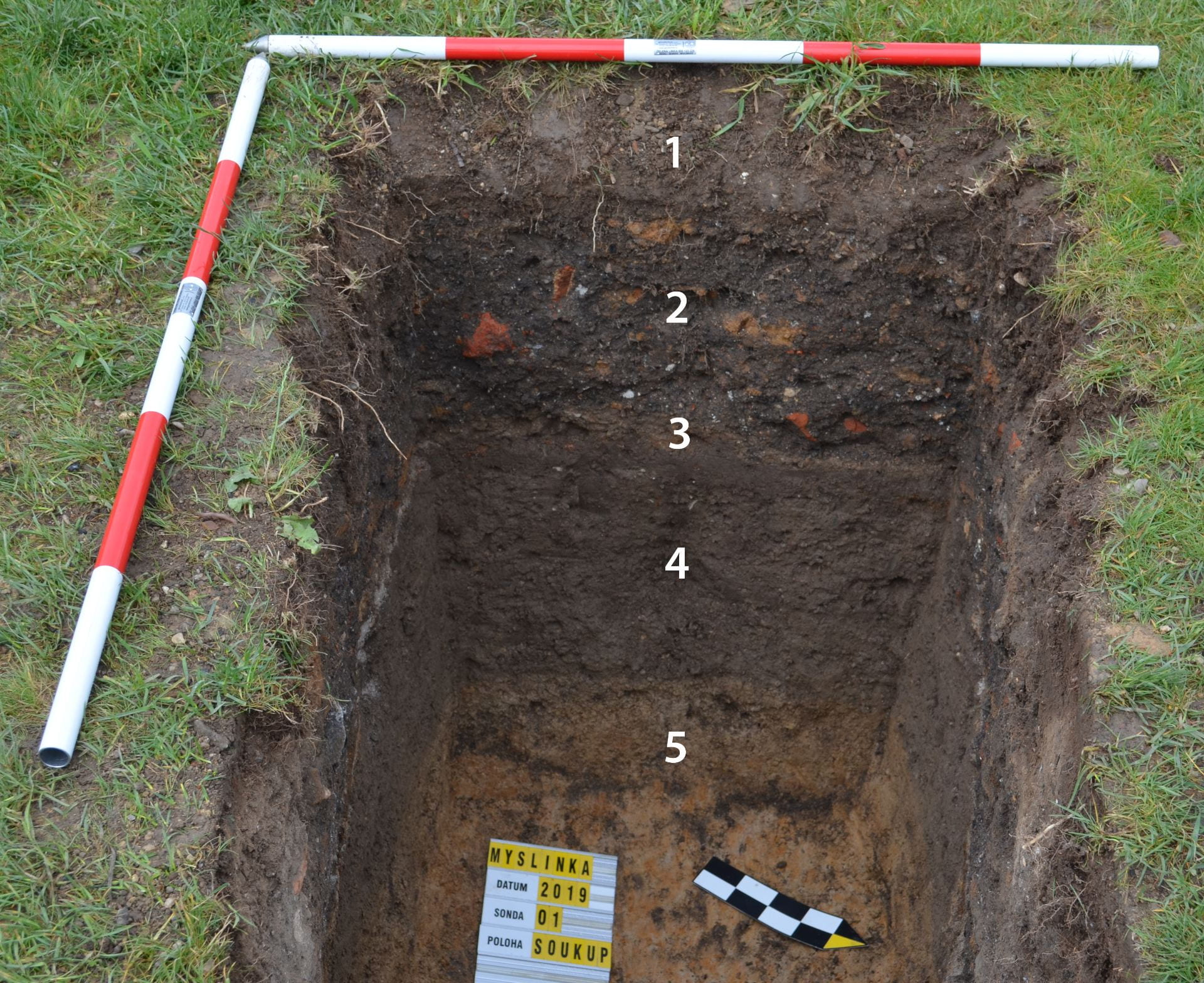
Of the test pits within the house plots, two (numbers 2 and 3) revealed former agricultural soils, with a handful of late seventeenth – nineteenth century sherds in test pit 2 linked to manuring. Test pit 1, sited in the back of house plot 2, revealed the original surface of the farmyard, covered with a thick layer of waste (mostly building debris and ash from stoves) mixed with early twentieth century artefacts.
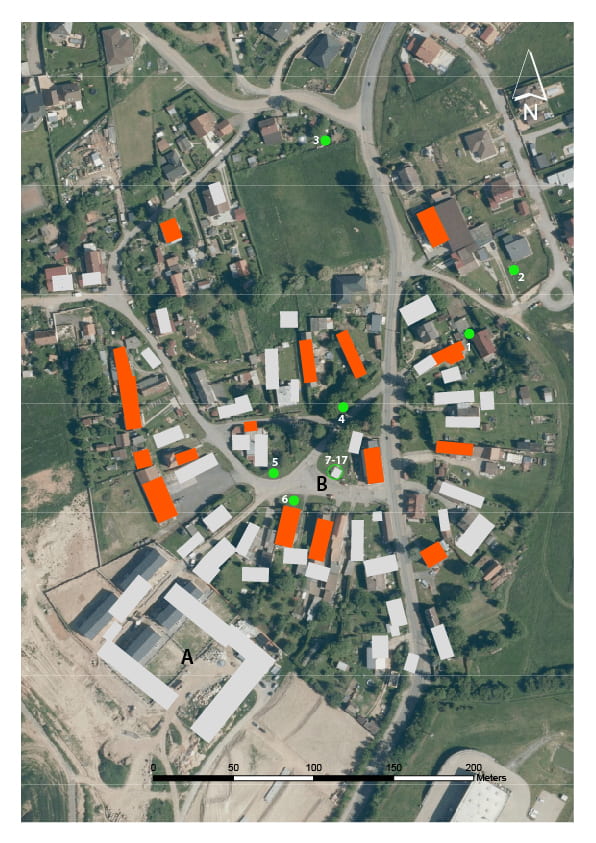
Three test pits were situated around the perimeter of the village green, on its northern (No. 4), western (No. 5) and southern (No. 6) sides. The first two pits revealed the ground surface of the green which contained a small number of late seventeenth – nineteenth century sherds, and showed the green to be overlain by thick layers of late twentieth century land-fill dominated by construction debris. Test pit No. 6 exposed the foundation of a clay-bonded stone wall which formerly defined the front of Farm Complex No. 9, but was removed in the late twentieth century when this part of the village green was used for waste disposal. Pottery dated from the late seventeenth – early twentieth century.
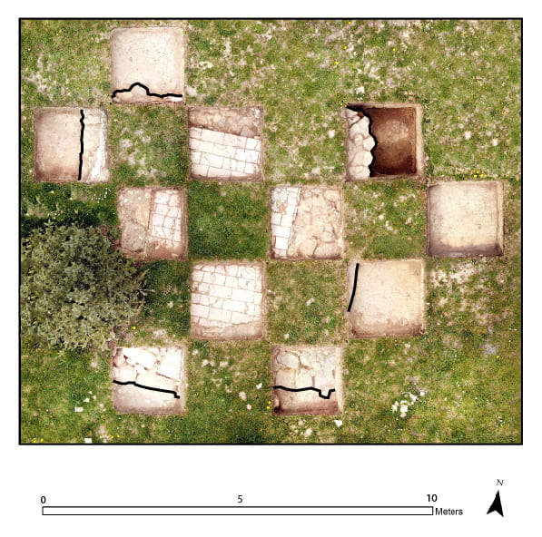
The remainder of the test pits were sited in the centre of the village green in response to a request by the municipal office to locate the remains of the baroque chapel, demolished on the orders of the local communist authorities in 1976. Historical maps were used to identify the presumed location of the chapel which was investigated by test pits. 7-17 (Fig. 5). The complete ground plan of the chapel measuring 4 x 4 m was uncovered just a few centimetres beneath the current ground surface. Well-preserved remains were represented by a 1m thick lime mortar-bonded stone wall and a red brick floor. Test pits around the chapel documented late twentieth century activity in this area (confirmed by local people), which included waste disposal, children’s play and parties reputedly involving considerable alcohol consumption, possibly represented by bottle glass found in the test pits, while traces of bonfires may be associated with the traditional “burning of witches” commemoration on the night of 30th April/1st May.
The test pit data suggest that the present village of Myslinka was established in the late seventeenth century, after the end of the Thirty Years War. With the exception of a few architectural features including components of the manor farm complex, the pre-twentieth century development of the village has left minimal material trace, represented mostly by thin layers containing pottery fragments, found both within house plots and on the village green. The excavations recorded significant discontinuity in the development of the village after WWII: changed attitudes to the locality are reflected not only in the demolition of historic architecture but also in waste disposal which was deposited in private as well as in public areas. Thick deposits containing building debris from ruined and demolished farms as well as domestic garbage was simply spread around.
The absence of any pre-late seventeenth century archaeological material suggests that when Myslinka was re-established after 1761, it was sited in a new, previously unoccupied, area. Surface survey has identified a potential location for the documented medieval village (deserted in the fifteenth century) c. 400 m to the north on a platform above the confluence of two streams. Test pit excavation in autumn 2020 is planned to test this hypothesis.
One important social outcome of the test pit excavations is that local initiatives to re-establish the chapel and renovating the village green can now be guided by the tangible excavated evidence.
Comments are closed.